|
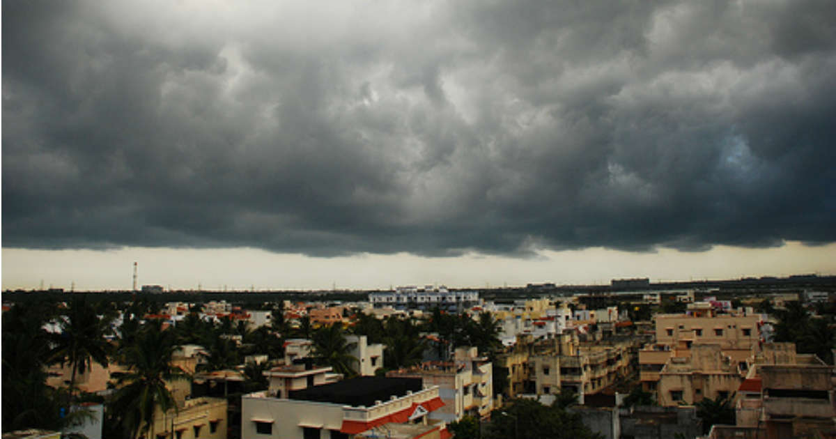
THE WEATHERMAN HAS WARNED FISHERMEN NOT TO VENTURE INTO DEEP SEA FOR A FEW DAYS FROM DECEMBER 5 ONWARDS. 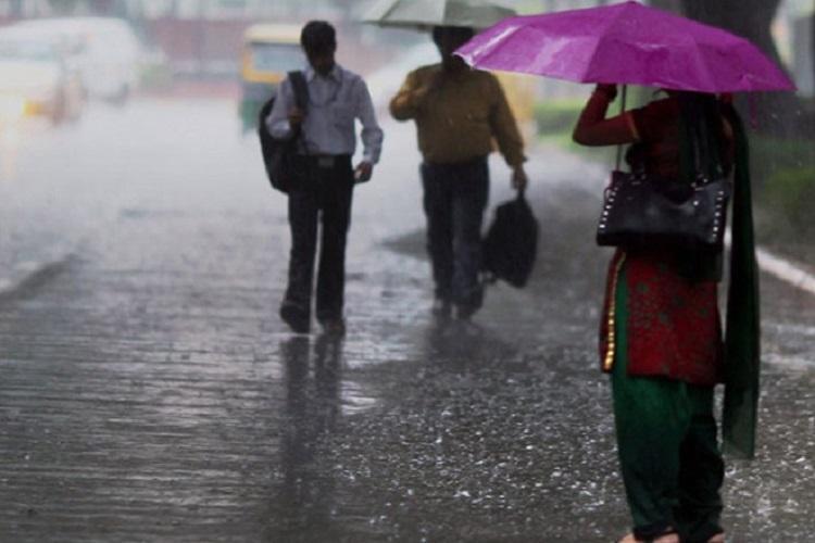 The Indian Meteorological Department has issued a weather warning, forecasting that a well-marked low-pressure area has formed over southeast Bay of Bengal. According to the weatherman, the condition of the sea is expected to worsen from December 5 onwards.
According to the weatherman, the low pressure is expected to intensify into a depression over the next 24 hours, and deep depression within the next 48 hours. As the depression is expected to intensify over the coast of north Tamil Nadu and south Andhra Pradesh, the IMD advised fishermen not to venture into deep sea for the next three to four days from December 5 onwards. Also according to the IMD, heavy rainfall is expected in isolated parts over Tamil Nadu and Puducherry on December 6, and heavy to very heavy rainfall on December 7 and December 8. Speaking to TNM, Y K Reddy, the head of IMD Hyderabad, said that there won’t be much damage. “Wind speed will be less than 60km/hour. As of now, we’re expecting it to be depression or deep depression at the maximum. It may not become a cyclone. We’re keeping a watch on it. As of now, the present situation is that it will cross as a deep depression over north Tamil Nadu and south Andhra Pradesh coast,” he said. Reddy also said that there was no need to worry about a cyclonic storm, as the intensity will be lesser. Wind speeds are expected to be at 50-60 kmph. If it was a cyclonic storm, the expected wind force would be 62-87 kmph, he said. According to IMD Chennai, light to moderate rain may occur in some areas of the city. Light to moderate rain is also expected in southern parts of Tamil Nadu. The weatherman also issued a weather warning for isolated rainfall over north Konkan on December 5. Minimum temperatures were appreciably below normal (-3.1 degrees to -5 degrees) at isolated parts in Andhra Pradesh and above normal (1.6 degrees to 3 degrees) at most places over coastal Karnataka, Rayalaseema, and at isolated places over Kerala.
KERALA AND TAMIL NADU ARE FACING THE WRATH OF CYCLONE OCKHI FOR THE SECOND DAY IN A ROW.
Kerala and Tamil Nadu are facing the wrath of cyclone Ockhi for the second day in a row, as heavy rain lashes on the southern and central districts of the states.
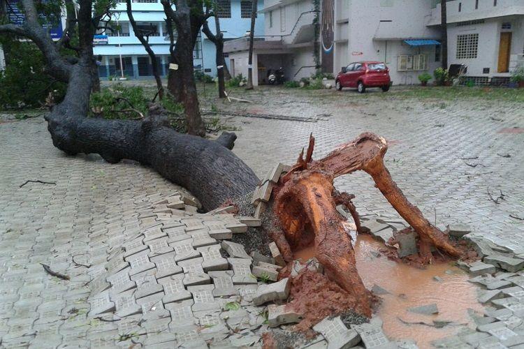
In Kerala, Ockhi has claimed four lives so far, 270 fishermen and 62 boats continue to be missing. In Tamil Nadu meanwhile, over 500 trees were uprooted as a result of the cyclone in Kanyakumari district, killing four residents. Over 825 people have been evacuated from low lying areas in the state. Disaster relief personnel are working round the clock to ensure safety of residents. The cyclone is positioned at 60 km south of Kanyakumari and 120 km southwest of Thiruvananthapuram, as per reports. The India Meteorological Department (IMD), is predicting that it is likely to move towards the Lakshadweep Islands and intensify further into a severe cyclonic storm in the next 24 hours. Emergency Operation Centre numbers, Kanyakumari District: 1077 , 04652231077 , 9442480028 , 9445008139
Updates from Social Stream
WINDS UPTO TO 65 KMPH ARE VERY LIKELY ALONG KANYAKUMARI, TIRUNELVELI, THOOTHUKUDI, RAMANATHAPURAM AND PUDUKOTTAI COASTS, SAID THE STATE DISASTER MANAGEMENT AGENCY.
Southern Tamil Nadu will witness heavy rains for the next 24 hours, said the Regional Meteorological Department with a deep depression lying about 170km southeast of Kanyakumari, over the Comorin area. IMD forecast heavy rains in districts such as Kanyakumari, Thiruvarur, Thoothukudi, Tirunelveli, Ramanathapuram, Virudhunagar, Madurai and Dindigul.
Following the Met Department’s prediction, collectors of Thiruvarur, Kanyakumari, Tirunelveli and Pudukottai districts declared a school holiday on Thursday. The Met Department is, however, yet to classify the deep depression into a cyclone, stating that they are keeping a close watch on the system and would alert residents accordingly. However, the Tamil Nadu State Disaster Management Agency tweeted, issued a warning stating, “The system is very likely to move west-northernwards and intensify further into a cyclonic storm during next 12 hours.” TNSDMA went on to say, “Under its influence, squally weather with wind speed reaching 45-55 kmph gusting to 65 kmph very likely along and off Kanyakumari, Tirunelveli, Thoothukudi, Ramanathapuram and Pudukottai coasts.” Noting that the sea condition will be rough to very rough, TNSDMA also advised fishermen in Kanyakumari, Thoothukudi, Ramanathapuram and Pudukottai not to venture into the sea.
The state disaster management agency also tweeted to say that around 50 trees had fallen in Kanyakumari after witnessing heavy gusts of winds since Wednesday night. The district has also received 34mm rainfall.
Meanwhile, the Met department has also predicted moderate to heavy rains in Chennai for the next 24 hours.
Weather blogger, Tamil Nadu Weatherman stated that Chennai would receive spells of rains through out Thursday. “More and more spells of on and off rains are expected throughout the day and some spells will be heavy at times. But all will happen with breaks. Chennai Meenambakkam has got 60 mm till now, Madhvaram 40 mm, Chennai City 32 mm, Shoillnganallur 31 mm, Katupakkam 30 mm,” stated Tamil Nadu Weatherman. |
follow our updatesCategories
All
|

 RSS Feed
